This will likely be a short post. We left Rock Rapids this morning and headed East on I-80. We made excellent time since the speed limit was 75 (as it is in most of the states out here) and the topography was surprisingly flat. The only really notable feature in the middle of Wyoming was out empty it was. When we started out in the West part of the state, there were ranches with cattle on them. When we got to the middle of the state, there were miles and miles of nothing but vast ranges of sage brush. Not a head of cattle, house or any other feature to break it up. It was a lot like the wheat fields we saw in Washington, but in this case, there were no crops. The Bureau of Land Management (BLM) apparently manages a bunch of the land. There are also wild horse herds out there, but we did not (as far as we know) see any. We did see lots of Prong Horn Antelope along the way browsing in the sage brush. As we got closer to Laramie and Cheyenne, we started seeing large herds of cattle and even crop fields.
We drove into Cheyenne and stopped at the state capitol building. The building was open and we went in to look around. I was interested in the fact that the legislator was only in session for 40 days one year and 20 days the next year. The 20 day session is to deal with budget issues only. I told the information person our legislator was in session for 90 days every year which just means they can cause more trouble. The senate has 20 members and the house appears to have about twice that many.
Mary asked the state trooper in the capitol building where was a good place to eat. He recommended a place named Sanford's but couldn't remember exactly what street it was on. I think it one of those "I know how to get there, I just don't know where it is" situations. We drove around and found the place in the general area he directed us to. We parked (angle parking only, no meters) and went in. The place was something else. It was full of, well, I guess you would call it stuff. There were lots of pictures on the walls of sports people but there was also all sorts of stuff just scattered about hanging on the walls and from the ceiling. The tables were stainless steel, and each one had a roll of paper towels next to it. The menu was mostly sandwiches and burgers with an apparent emphasis on quantity. We all enjoyed the meal as much for the "decor" as the food (which was good).
From Cheyenne we headed south on I-25 toward Denver. Sheila wanted to stop in Longmont where some members of the Byrne family (Mary and Sheila's grandmother was a Byrne) were buried in the Mountain View Cemetery. We found the cemetery (actually the navigation system did) and arrived at 4:20 pm. Unfortunately, the administrative office closed at 4:00 pm. So, we were faced with searching an area about 2 blocks by 2 blocks with hundreds of graves for the ones the Byrnes were buried in. We began slowly driving around what appeared to be the older sections (the father died in 1933) looking for the Byrne name. We had covered just about the whole place and were on about the last lane when Sheila had me stop and back up. Sure enough, there it was! We all jumped out and took lots of pictures of the various markers and Sheila took down some information on one of them that might help her fill in some gaps in the genealogy she is working on. We were all amazed that we had actually found the graves as we really didn't have much hope for success when we started looking.
We arrived in Denver and found our hotel (downtown Hampton) around 6:00. It is such an understatement to say that the city has changed. We lived here in 1968 and came back in 1975 on a camping trip to the mountains. It had changed quite a bit in the 7 years between those visits, but now it has been 32 years since our last visit. The baseball stadium (Coors Field) is downtown (Denver didn't have a baseball team when we here before) and there are many more tall buildings. In a way it is kind of disorienting. The only things we found that were unchanged were the capitol building and the Catholic Cathedral. They have converted several blocks of 16th Street to a shopping mall. It is, in many ways, like any other shopping mall except that it is all along the street. There is not traffic on the street except shuttle buses that run continuously and stop at each corner. The buses are free and you just get on and off as you wish. Our objective was to find interesting shopping places for Sheila and a good brew pub for me. Since the place is like any suburban mall, Sheila pretty much struck out. However, we did find a brew pub that served up fairly good food and a reasonable menu of beers.
We rode the shuttle back to the area where our hotel is located, then walked over to the capitol. We got a few night pictures of the building (it has a gold dome) and walked up the stairs to where the markers show the altitude of one mile above sea level. We then walked back to our hotel to call it a day. Tomorrow we will explore some our (Mary and me) old haunts, look for some shopping places and maybe head down to Colorado Springs.
Tuesday, July 31, 2007
Monday, July 30, 2007
Day 20 Grand Tetons National Park
Today we checked out of our hotel in West Yellowstone and headed to the Grand Tetons National Park. We drove back into Yellowstone, around the Southern loop and out the South Entrance. Grand Tetons is directly South of Yellowstone. On the way, we saw and photographed one more water fall (Lewis Falls) in Yellowstone. As usual we were sorry to leave the park. We all agreed that you could easily spend a week in Yellowstone and full days every day.
As we headed south, we began to see the Grand Tetons range ever more clearly. What a sight it is. The peaks are very rugged. We stopped at the visitor's center to purchase some items and for Mary to get her stamp in her National Parks Passport book. We also went to the general store for the usual assortment of souvenir stuff and to stock up on snacks and water.
When we left there, Mary spotted a chapel (the Chapel of the Sacred Heart) marked on the guide map, so we stopped there. She and Sheila went and I took more pictures. The chapel was completely of log construction and was donated by New York and Wyoming families as a memorial to the victims of the September 11, 2001 attacks.
As we continued South we stopped at several turn outs to get more pictures and read more about the mountains. There are about a dozen glaciers on the Grand Tetons, and we saw about 6 of them. I think we all agreed that the most spectacular view was from the turn out where we saw the Cathedral Group. This group of peaks really does soar to the sky. We spent quite a bit of time there taking pictures and looking at the peaks and glaciers through the binoculars and spotting scope.
We had always planned to drive through the GTNP, but had not had any real plans for where we would go next. The Grand Tetons NP is fairly small (especially compared to Yellowstone) and did not take long to drive through. We discussed the next destination a couple days ago and decided on Denver, CO. It won out over Salt Lake City primarily due to time constraints. Sheila has never been to Denver, and Mary and I were last there in 1975 (we were stationed there in 1968 for 5 months). So, after leaving GTNP, we headed down to Rock Springs, WY. We arrived here about 4:30 and immediately made use of the laundry room. We were all down to our last items of clean clothes. We had a quick dinner and now we are going to get a (hopefully) long nights sleep. We plan to spend two days in Denver then get on I-80 and head East.
We have had a lot of very full days. Each day finds us pretty well exhausted at the end. But no one yet has said that it has been too much. After a night's sleep, we are ready to go to the next adventure. We may be tired at the end of each day, but we are not tired of the adventure.
I forgot to mention that we completed our animal viewing list during our visit to GTNP. The only large mammal we did not see by the time we left Yellowstone was a moose. There are not many in Yellowstone and there was no mention of them in Glacier. However, Grand Tetons is known for their moose and it did not disappoint us. At one of the turnouts, a number of people had stopped and walked out into a meadow. Of course we stopped to investigate. Off to the side from where people were standing was a female moose down in the brush. At this time of the year, where an adult female of any of these large animals is located, there is likely a youngster near by. We walked on around the area where she was browsing, and sure enough, there was her calf almost completely hidden by the brush. After a bit, they both started moving a bit and then we could see them really well. In case you are interested or concerned, the regulations require you to stay at 25 yards away from moose, buffalo, and deer. All the people at that location were complying with that requirement easily. In fact, we were all probably about 50 yards from them. Anyway, we now have completed our "want to see" list of large mammals. We also have several small animals on the list of "we saw that": Marmot, pika (sort of like a large chipmunk), various types of ground squirrels (Uinta at Yellowstone), gopher, prairie dogs, eagles, ospreys, magpies, ravens and others that I'm sure I've forgotten to list.
Sunday, July 29, 2007
Day 19, July 28: Yellowstone NP
Today we drove the North loop of the Grand Loop Road. But first, we decided to hike up Mt. Washburn. According to the information we had, Mt. Washburn was one of the best places to see Big Horn Sheep. So, when we came to the trail, we decided to give it a go. The trail is 3 miles long, starts at 8900 feet and climbs about 1400 feet and we are fairly old. Just wanted to let you know what we were up against. We took two bottles of water, our cameras and binoculars and started the climb. The trail started quite steep then became easier after about a half mile. Then it got difficult again and remained so. At some point, we came to the conclusion that "we've come this far, we might as well go all the way". It was a tough climb. The only good thing was that the views out over the park got better as we got higher. We stopped many times to admire the view (yeah, that's the reason). Just before we got to the top, we saw a Big Horn ewe and two lambs. Another extended stop was called for. After about 2 1/2 hours, Sheila and I made it to the top. Mary was having some problems with her asthma and decided to wait where we had seen the sheep. At the top of the mountain is a fire lookout station, and the fire lookout person / ranger was watching over a young female Big Horn that was wandering around amongst the people there. Shortly after we reached the top, my phone rang. What a surprise. I didn't expect to have cell service there. It was Mary. She had seen about a dozen Big Horns just below where she was standing. I told her the rest of the climb to the top was really not too bad (I only lied a little), and she should come on up and join us. Which she did. We spent about a half hour up there admiring the views, going potty, and replenishing our water. We also took pictures to ensure we had photographic evidence that we had climbed to the top.
When we headed down, we could see a bit of a rain storm coming and hear some thunder. We didn't want to be on top of the mountain if we were going to get a thunderstorm, so we really picked up the pace. If you have ever done that kind of a hike, you know that going down has its problems. The trail was wide but fairly rocky, and it got to be difficult to maintain the pace while picking our way through the rocks. We made it to the bottom in about an hour just as the rain started. We scurried to the car and managed to avoid getting too wet. We had spent about 4 hours on that adventure and added another animal to our "we saw those" list.
From there we drove on around the loop and turned off toward the North East Entrance via an area called Lamar Valley. This area is referred to as the Serengeti of North America due to the abundance of wild life there. So what did we see? Lots of wild life. First there was the coyote that just kind of popped out of the brush on one side of the road, crossed right in front of us, continued down the road a way and went into the woods on the other side. Another addition to our list.
We continued on to a meadow where there was a small herd of Prong Horn Antelope grazing. When we looked closer, we saw there was also a member of the canine family amongst them. I was sure it was another coyote, Sheila was sure it was a wolf and Mary noted that it was wearing a tracking collar. The interesting thing was that the dude was just ambling along, but the Prong Horns were staying right with it. There was one male in the herd, and at one point he did charge and chase it off a bit. For the most part, they were just going along with it. Later after much discussion and review of the video evidence, we all agreed that it was a wolf (I did end up with some knots on my head from the beating). I think the key is the fact that it was wearing a tracking collar. I doubt they are tracking coyotes. I also believe the antelope were just keeping an eye on the wolf. As long as they were able to see it, it presented no threat to them. I also believe the wolf was a loner (an outcast?) and was not eating real well. He was pretty sorry looking. So, two more animals were checked off our list.
We drove a bit further and ran into a bear jam. That is what they call what happens when a bear is sighted and the cars start to pile up as folks slow or stop to look. The rangers respond pretty quickly and (as long as there is no danger) will tell people where the bear is located and where they can or cannot stop. In this case, it was a grizzly in amongst the sage brush. We found a parking and broke out all our equipment (cameras, binoculars and spotting scope). Mary set up the spotting scope and started looking in the area where others were indicating. Eventually, she said she saw the bear pop up his head for a moment then disappear in the brush again. A ranger there said the bear was on a buffalo carcass. That would explain why it was hidden in the brush and was not moving about. Sheila and I could not see the bear and had to take Mary's word for the sighting. And we did take here word for it. Of course we had seen grizzlies in Glacier, so they were already checked off our list.
A bit further along in the Lamar Valley is the Buffalo Ranch where the park service took steps to bring the buffalo back from the point of extinction. The number of buffalo in the park got down to about 28 head early in the 20th century. Keep in mind that there were once an estimated 60 million head on the plains before the government tried to eradicate them to keep the First Nations people from having access to them. Anyway in the ranch area of Lamar Valley, we saw more large herds roaming freely.
Eventually, we turned around and returned to the Grand Loop and headed up to the North Entrance. At the park entrance there an arch was constructed to honor President Theodore Roosevelt. We drove out of the park, then turned around and parked and took several pictures. The arch is featured in a lot of early pictures of the park.
From there we went to an area called Mammoth Hot Springs. This is a really, well, mammoth geothermal feature. It is comprised of several springs and geysers that output water with tremendous amounts of minerals in it. As a result, the surrounding deposits are being built up at very high rates (as much as an inch a year compared to Old Faithful's inch a century or so). The deposits have built up in the form of terraces. After seeing so many geothermal features in the park, we might have been a bit jaded. However, this area still had a lot of wow factor.
By the time we finished with Mammoth Hot Springs, it was starting to get pretty dark. We just headed back to West Yellowstone and the end of another day.
So here is a tally of our animal sightings in Yellowstone:
That leaves only a moose on our to see list. Maybe tomorrow.
We were all pretty exhausted (remember the bit about the climb up Mt. Washburn) and ready to get some sleep. Tomorrow we do the Grand Tetons.
When we headed down, we could see a bit of a rain storm coming and hear some thunder. We didn't want to be on top of the mountain if we were going to get a thunderstorm, so we really picked up the pace. If you have ever done that kind of a hike, you know that going down has its problems. The trail was wide but fairly rocky, and it got to be difficult to maintain the pace while picking our way through the rocks. We made it to the bottom in about an hour just as the rain started. We scurried to the car and managed to avoid getting too wet. We had spent about 4 hours on that adventure and added another animal to our "we saw those" list.
From there we drove on around the loop and turned off toward the North East Entrance via an area called Lamar Valley. This area is referred to as the Serengeti of North America due to the abundance of wild life there. So what did we see? Lots of wild life. First there was the coyote that just kind of popped out of the brush on one side of the road, crossed right in front of us, continued down the road a way and went into the woods on the other side. Another addition to our list.
We continued on to a meadow where there was a small herd of Prong Horn Antelope grazing. When we looked closer, we saw there was also a member of the canine family amongst them. I was sure it was another coyote, Sheila was sure it was a wolf and Mary noted that it was wearing a tracking collar. The interesting thing was that the dude was just ambling along, but the Prong Horns were staying right with it. There was one male in the herd, and at one point he did charge and chase it off a bit. For the most part, they were just going along with it. Later after much discussion and review of the video evidence, we all agreed that it was a wolf (I did end up with some knots on my head from the beating). I think the key is the fact that it was wearing a tracking collar. I doubt they are tracking coyotes. I also believe the antelope were just keeping an eye on the wolf. As long as they were able to see it, it presented no threat to them. I also believe the wolf was a loner (an outcast?) and was not eating real well. He was pretty sorry looking. So, two more animals were checked off our list.
We drove a bit further and ran into a bear jam. That is what they call what happens when a bear is sighted and the cars start to pile up as folks slow or stop to look. The rangers respond pretty quickly and (as long as there is no danger) will tell people where the bear is located and where they can or cannot stop. In this case, it was a grizzly in amongst the sage brush. We found a parking and broke out all our equipment (cameras, binoculars and spotting scope). Mary set up the spotting scope and started looking in the area where others were indicating. Eventually, she said she saw the bear pop up his head for a moment then disappear in the brush again. A ranger there said the bear was on a buffalo carcass. That would explain why it was hidden in the brush and was not moving about. Sheila and I could not see the bear and had to take Mary's word for the sighting. And we did take here word for it. Of course we had seen grizzlies in Glacier, so they were already checked off our list.
A bit further along in the Lamar Valley is the Buffalo Ranch where the park service took steps to bring the buffalo back from the point of extinction. The number of buffalo in the park got down to about 28 head early in the 20th century. Keep in mind that there were once an estimated 60 million head on the plains before the government tried to eradicate them to keep the First Nations people from having access to them. Anyway in the ranch area of Lamar Valley, we saw more large herds roaming freely.
Eventually, we turned around and returned to the Grand Loop and headed up to the North Entrance. At the park entrance there an arch was constructed to honor President Theodore Roosevelt. We drove out of the park, then turned around and parked and took several pictures. The arch is featured in a lot of early pictures of the park.
From there we went to an area called Mammoth Hot Springs. This is a really, well, mammoth geothermal feature. It is comprised of several springs and geysers that output water with tremendous amounts of minerals in it. As a result, the surrounding deposits are being built up at very high rates (as much as an inch a year compared to Old Faithful's inch a century or so). The deposits have built up in the form of terraces. After seeing so many geothermal features in the park, we might have been a bit jaded. However, this area still had a lot of wow factor.
By the time we finished with Mammoth Hot Springs, it was starting to get pretty dark. We just headed back to West Yellowstone and the end of another day.
So here is a tally of our animal sightings in Yellowstone:
- Elk
- Buffalo
- Big Horn Sheep
- Coyote
- Prong Horn Antelope
- Wolf
- Grizzly Bear (also seen in GNP)
That leaves only a moose on our to see list. Maybe tomorrow.
We were all pretty exhausted (remember the bit about the climb up Mt. Washburn) and ready to get some sleep. Tomorrow we do the Grand Tetons.
Day 18, July 27: Yellowstone NP
Yellowstone National Park (YNP) has a road named Grand Loop that loops around the park in a figure 8. We decided that we would drive the whole thing the first day and then figure out what we wanted to do the second day here. We started out on the southern loop which is around 100 miles. Of course, as we started out, we had to stop at every meadow where we saw elk, a geothermal feature, a vista or a water fall. We stopped a lot! At one of the geyser locations, we were leaving the parking area to get back out on the road when we saw a lone buffalo grazing near the road. We all got very excited (especially Sheila) and got some pictures of it. It was our first buffalo in the wild. I was sure we would see more.
Most of our time was taken up with exploring the geothermal features. Lots of geysers, steam vents, springs, pools, and mud pools. Sheila bought a guide book when we first went in to the Old Faithful Inn (see Day 17). It turned out to be a very informative book. So with me driving, Mary navigating and Sheila narrating (reading from the book), we had a great tour. By around 11:30 we were back at the Old Faithful geyser which was due to erupt about 15 - 20 minutes after we arrived. There must have been over a thousand people gathered around. We each got into positions for the big event and about 5 minutes after it's predicted time (well within the + or - 10 minutes the rangers claim), Old Faithful put on its show. I got a bunch of still shots, Sheila and Mary got videos from different angles, and Mary got "rained" on from the water. It was one of those things that you want to see at least once and we all enjoyed it.
After a quick lunch there, we continued on our journey around the southern loop. The scenery continued, but we decided not to stop at every steam vent we came to. There are hundreds of them. We drove around Yellowstone Lake which is large and beautiful and turned off the Grand Loop Road to head out toward the East entrance. We were hoping to see lots of wild life, but came up empty, so we turned around to head back toward the Grand Loop. A little way on we passed a grove of trees near the rode and Sheila saw a buffalo walking along parallel to the road going the same way we were. We pulled into a turn out just past the grove of trees and waited. Sure enough here came the buffalo. That was when I spotted the trail (buffalo trail) leading out of the woods directly toward where we parked. I decided to move. Good thing. The guy ambled out of the woods, down that trail and across the parking area directly in front of us. He just continued on like he knew where he was going and when he needed to get around a small lake, he just walked out in the road and continued on down the right hand lane. No hurry, just going over to the next meadow. It was quite the sight.
Continuing around the southern loop, we got to an area called Hayden Valley where we encountered a large herd of buffalo grazing. We estimated somewhere between 100 and 200 animals in there including several calves with their mothers. This was quite a sight. We all agreed that this is the way it should be: Large herds of buffalo free ranging.
From there, we went to an area called Canyon Village where we could go out on the North Rim of the Grand Canyon of the Yellowstone. What an impressive sight! The Yellowstone River has cut the canyon along with the help of fractures and fissures in the lava from the volcano. The canyon is about 24 miles long and runs about 1400 feet deep. Not quite up to the scale of the Grand Canyon, but still very impressive. The colors and geological formations were amazing.
By the time we finished at the canyon, we were all quite tired. We had decided much earlier in the day that we could not possibly complete the entire Grand Loop in one day, and that we would do the Northern loop the second day. We headed back to West Yellowstone and stopped at a restaurant called Bullwinkle's for dinner. The gals went shopping, and I returned to the hotel to download pictures and post blogs from Glacier, etc.
We really learned a lot about the park today. We learned that it is the world's largest volcano and that most of the park is actually the volcano's caldera. We learned that most of the colors we see in the geothermal features are from heat loving bacteria that can not survive at the low temperatures we are used to. We learned that the park is constantly changing due to the build up of deposits from the various geysers and thermal pools. We learned that there is way too much to see to do it in one day (or two, or...).
We (mostly Sheila) had a list of animals we wanted to see in the park that we had not seen at Glacier: Elk, Moose, Big Horn Sheep, Prong Horn Sheep, Buffalo and most of all wolves. Today we ticked off only two of those (elk and buffalo), but we have high hopes for tomorrow.
So now it is late on the second day and I am one day behind on blogging. I also need to upload some pictures to Picassa. Tomorrow (day 20) we are going down through Grand Teton National Park. Hopefully, I will be able to catch up tomorrow night.
Saturday, July 28, 2007
Day 17 July 26: Glacier to Yellowstone
As much as we hated to leave Glacier, we were anxious to get to Yellowstone. We set out on US-2 with some backward glances. We hadn't gone far when we saw some Blackfeet cowboys on their horses working a herd of cattle. They appeared to be separating the calves from the rest of the herd. It was such a classic scene with the mountains in the background, that we turned around so we could get some pictures.
We drove through a portion of the Blackfeet Reservation including Browning which is the Blackfeet capital. It was interesting to see the mix of some of the old traditions as evidenced by sweat cloths hanging in trees with the more modern. Browning was not a large town, and was obviously not real prosperous, but it didn't appear desolate or poverty stricken either.
We made our way over to I-15 and headed south toward Yellowstone. When we realized we would go right by Helena, we all agreed we should take a drive around the city. We quickly found the Capitol building and took a walk around the front of it. We opted to not go in due to the time constraints. Then we visited St. Patrick's Cathedral which was built in the Gothic style in 1908. It is a beautiful building with lots of stained glass (from Germany) and marble (from Italy) in the interior. After a quick stop at McDonald's (not for food) we headed back on to I-15 south.
While the trip over to I-15 from Glacier had been through mostly rolling hills and plains, the landscape became more mountainous again as we went south. Soon we were in some pretty tight curves and steep hills where the normal posted speed of 75 mph was a bit too fast. Some of the curves were posted at 45 mph (remember this is Montana interstate) and they were exciting. Along the way we passed a truck while doing about 70 and got a rock to the windshield. It hit on the edge of the windshield about half way up on the passenger side. It took a divot out of the glass and a crack quickly formed and began growing toward the driver's side. By the end of the day the crack was about 10 inches long. We are hoping it will not grow too much more and we will be able to get home before we have to take care of it.
We arrived in West Yellowstone about 6:15 pm and checked into our hotel (Comfort Inn). We immediately headed out to the park to drive around and check into tours. We stopped at a point along the Madison River where we saw an elk herd grazing. Our first large mammals in Yellowstone! We continued on to the Old Faithful Inn where we wanted to inquire about Yellow Bus Tours (like the Red Bus in Glacier). We also wanted to see the place since we had heard so much about it, and it is number one on the list of "Great Lodges of the National Parks". The place is awesome. It does not have the large diameter, soaring logs supporting it like Glacier Park Lodge, but is essentially all log construction. Two levels of mezzanines overlook the lobby which has a huge, four sided fire place in the very middle. By the way, the lodge sits at about 7000 feet elevation, and the temperatures were cool (low 60s). We decided to see if we could get into the restaurant for a light (yeah, right) dinner. The restaurants in these lodges are fantastic, and so is the food. After checking on the bus tours we had decided to do it ourselves, so after dinner and some shopping, we headed back to the hotel (about 40 miles) to end the day.
Pictures coming soon.
Day 16, July 25: Going to the Sun Road, GNP
Today we took another Red Bus tour that made a complete loop in and around the park. But first, a bit about the Red Buses. They were built around 1936 to 1938 and served to provide motor tours of the park. They were, of course, manual transmission vehicles and the drivers had to jam them into each gear as they went up and down the mountains. As a result the drivers were (and still are) called "Jammers". One of the main characteristics of the buses (other than their color) is that they are convertibles. They have a heavy tarpaulin cover that can be pulled back opening up the top. With the top open, you have a fantastic view of the mountains. The buses were owned by a concessioner in the park. By the 1960s they were starting to become a problem to maintain and eventually the department of transportation took them out of service. The buses were a favorite of park visitors and the superintendent of the park worked a deal where the park would take possession of them and the Ford Motor Company would refurbish them. Basically, Ford put the body on a truck chassis with V-8 engines that will run on either propane or gasoline. And that's the story of the Red Buses. Now, they run several tours in and around the park, and it is a great way to see the park and while getting a narrative about the various points of interest.
The tour we were on today went from East Glacier (where we are staying) to West Glacier by way of US-2 (the way we came to get here). Us-2 crosses the continental divide at just around 5000 feet (the lowest crossing in the park). Just past the Continental Divide is a place called Goat Lick where the mountain goats come to (you guessed it) lick the rocks that contain a mineral they need. We saw a mother goat and her kid climbing the rocks. I took lots of pictures.
At West Glacier, we entered the park and drove up to Going to the Sun Road. That road crosses back from West to East along the Garden Wall mountains (more about that in a moment) crossing the Continental Divide at Logan's Pass at about 6500 feet elevation (well above the tree line). The Garden Wall is actually a large uplift that was carved on two sides by glaciers during the last ice age. As a result, the remaining mountains look a lot like a rock wall: High and long but not very wide. The Going to the Sun road starts at the bottom of the West side of the wall and climbs up going North to a switch back where it then goes along what is essentially the face of the wall until it is about three quarters of the way to the top. That is where the pass is located and it is the highest point on the road. The views were fantastic. Today was another cool (mid to upper 70s) and clear day so you could see forever. As you might expect, since the road is just cut into the very steep face of the mountain, it is an adventure for those sitting on the right side of the bus. The driver assured us all would be OK because all he had to do was follow the yellow line in the middle of the road. Some of our fellow passengers were not really into looking down the drop off, and when we stopped for viewing opportunities, some would not get out of the bus to partake.
The Going to the Sun road goes to St. Mary on the East side (where we were yesterday) and from there the tour returned to the lodge. So that part of the trip was a repeat of some of what we did yesterday. But we still enjoyed it.
After dinner tonight we hung out in the lobby and listened to Curly Bear Wagner (yup, that's his name) tell some stories to illustrate the Blackfeet way of life. He was very good and it was very interesting. He didn't shy away from the fact that the Blackfeet didn't get along well with any of the other nations.
I took a gazillion pictures today, and as soon as I can get back on the internet I will try to find time to get a sampling uploaded. For now we have pretty much packed up and loaded some stuff in the car. Tomorrow is another moving day: We are going to Yellowstone National Park. As much as we hate to leave Glacier, we are looking forward to Yellowstone.
Pictures have been uploaded. Check them out here.
Day 15, July 24: Glacier & Waterton
Today was fantastic. Where as the previous days were hot and hazy (including yesterday), today was breezy, comfortable if not cool, and the air was very clear. We took a Red Bus tour to the Prince of Wales lodge in the Waterton portion of the International Peace Park (Glacier / Waterton). Although the lodge was fantastic, the destination was not the real objective: the trip was. What can I say. The views were spectacular, the mountains very rugged, and we saw Grizzlies! We saw lots of Grizzlies. The bus tour started here at Glacier Park Lodge where the three of us were the only passengers. On the way to Waterton, we stopped at St. Mary then Many Glacier Hotel for additional passengers. At Many Glacier we saw a grizzly sow and her cub a couple hundred yards up the hill on the way in. Then on the way out, we saw what was likely a male about as far away at another location. We stopped at both lodges for potty breaks and to check out their gift shops.
We got to Prince of Wales Lodge around 1:30 pm. The Canadians charge CAN$5.20 for entry into their parks. Today the US and Canadian dollars were on par with each other. Seems like a pretty good deal. Most US National Parks charge at least double that. Of course my National Parks old person pass did not work there. We had lunch there and spent time enjoying the fantastic views there. After leaving the lodge, our driver went down into Waterton (the town). He stopped at a little store that sold ice cream, chocolates, home made pies, fudge, etc. I can't believe we all had ice cream and chocolates after the lunches we ate.
On the way back to the United States, we saw the smoke from a small forest fire. The guy at the border said they had just discovered it about an hour and a half before we came through. It has really been hot and dry all through this area and fires are a big problem right now. Today's wind certainly didn't help matters. One of the areas we drove through was the scene of the Red Eagle fire last year. It was a huge are of devastation.
So we got back to Many Glacier Hotel and saw another grizzly just ambling through the woods headed toward the lodge. That was the closest we got to one. Then on the way out, we saw what we think was the same sow and cub from this morning, but much closer to the road (about 100 yards away). Mary spotted this one for us. We got lots of good pictures of her.
We finally got back to our lodge at about 7:45 tonight. We had a quick meal of appetizers and desert in the restaurant and now it's off to bed. We need to rest up for another bus tour tomorrow over Going to the Sun Road. Again, it is the trip that is the objective. Details to follow.
Day 14, July 23: Spokane to Glacier
I am writing this while at Glacier Park Lodge, but will not be able to post it for a few days. Details follow.
We left Spokane on US Highway 2 headed for Glacier National Park today. As I said, the area around Spokane is relatively flat. As we headed north and east we got more into the foot hills of the Rockies and the terrain became much hillier. The road was pretty good though mostly 2 lane with occasional passing lanes on climbs. It followed rivers that flowed out of the mountains and remained relatively straight with just a slight upgrade for the most part. We did hit one part where it appears they are widening the road to 4 lanes. We had to sit about 15 or 20 minutes waiting to get through the construction area. Once we got going, it was stop and go as we had to yield to construction equipment at various points. The roadway was mostly packed dirt and the construction zone went on for about 2 miles. Fortunately, Sheila was driving, so I just relaxed and "enjoyed" the ride.
As we got closer to the park, the mountains got more rugged and the vistas were fantastic. As can be expected there were areas where we drove along the edge of a mountain and could look down into a valley very far below us. Other places we went along mountain lakes that were mirror smooth. I took some pictures out the windows of the car and we stopped at a couple of places.
When we got to the area along the southern boundary of the park, we saw a huge cloud of smoke ahead of us. It was obviously a forest fire. The area south of the park is a national forest, and the fire was somewhere in there. We got close enough that we could smell the smoke. We all agreed that was as close as we wanted to be.
We arrived at Glacier Park Lodge around 4:30 pm MDT. The lodge is exactly as we expected. We had seen the lodge on a PBS program about the great lodges of the national parks. The lodge was built on the Blackfeet Reservation in 1914 by the Great Northern Railway. Large trees were used as the main supports in the lobby colonnade. There are 60 Douglas firs and cedars, 36 to 42 inches in diameter and 40 feet long that provide support in the lobby and for the verandahs. They estimate the trees were 500 to 800 years old when they were cut. The lodge now has an annex and has 161 rooms for about 500 people. There is no TV, no air conditioning, no internet access, limited cell phone service and one ice machine for the whole place. It's great! It is a bit hot but the humidity is low. I think the day time highs are in the mid 80s. It suppossed to get down to low to mid 60s at night, so we'll see how it goes.
After we ate dinner in the restaurant in the lodge (I had bison stew), we went for a bit of a drive on the road that runs up the east side of the park (Looking Glass Hill Road). It went up to about 6000 feet and was a classic mountain road. We pulled over a several times to take pictures and got some great shots of the sunset behind the mountains. We only drove about 8 miles (mostly at about 25 - 30 mph) then turned around and headed back. On the way back we saw a black bear. Mary saw it first. It was just ambling along the road, then suddenly took off at full speed up the hill side. Everyone was quite excited. We drove around a bit more as it started to get darker, but did not see anymore wildlife other than chipmunks and one rabbit.
Tomorrow we go on a bus tour up to Prince of Wales Lodge in the Canadian portion of the park. Hopefully we will see more wildlife during the day. That's it for today.
Monday, July 23, 2007
Day 13, July 22: Heading East
We are heading east for the first time in nearly two weeks. It's been nearly two weeks since we started on this venture! But first the daily details.
I've heard it said that, when you are planning for a trip, lay out all the clothes you think you need, then only pack half of them. We didn't do that, but I thought we had done a pretty good job of limiting what we brought. We ended up with two weekender bags for clothes and one gym bag for other stuff needed by old people (drugs, vitamins, etc.). We had a system where we just took the gym bag into a hotel with a change of clothes one night, then the whole mess the next night. It soon became apparent, that we just didn't need all the clothes we brought. The same went for Sheila who also brought a weekender and a smaller bag for her clothes. Since Aunt Maureen and her daughter Sharon drove to Seattle and were going directly back to Iowa and had plenty of space in their car and agreed to take some stuff back for us, we decided to cut back a bit. Sheila sent a bunch of her clothes and Mary and I pared down from two weekender suitcases to one. This is so much nicer. We can pack and unpack the car in half the time, and we really don't even need a cart at the hotels to get our stuff to the room. And Sheila says there is now more room for stuff she buys!
Anyway, we got up this morning and went to church. The Blaesing branch's newest addition was baptized during mass. It was a very nice service and gave Mary and Sheila one last opportunity to say good bye to folks.
Today was to be another transit day: Just get from Seattle to Spokane. However, Sheila enjoyed the drive to Leavenworth, WA so much yesterday, that she suggested we take that route. It turned out to be a great idea. Leavenworth sits in the lee of a range called the Icicle Mountains. Back in the 60s, the towns people decided to remodel the town to an Alpine / Bavarian motif. It has turned out to be a big success for them, and they now have something like 17 festivals a year there. The drive over there from Seattle is beautiful. We followed along the Snokomish River to Stevens Pass (4000+ feet) through the Cascades. We stopped at some very picturesque falls along the way. After we went over the pass, we followed the Watachee River down for a ways. This whole route (US 2) seems to follow the original Great Northern Railway route through the Cascades. That rail route is noteworthy because it opened up access to the North West that had been hampered by the Cascade Mountains. We really enjoyed the stop in Leavenworth (particularly the Ice Cream lunch).
Our plan was to stay on highway 2 all the way to Spokane, but the lady in the navigation system had other ideas. We ended up veering a bit south toward I-90 at Watachee before we realized what had happened. That area of the state (the middle region) is fairly flat and has lots of apple orchards. We saw some really large orchards along the way. Eventually we decided to head back toward highway 2 and go to the Grand Coulee dam. As we got further to the north, the landscape changed again to be much more rugged. The land was obviously shaped by glaciers and worn by water. The vistas were incredible. I took a few pictures, but I don't think they can do justice to what we saw. As Mary says it was "high on the wow factor". Sheila said it looked like what you see in all those old westerns where the outlaws are hiding out up on the rock outcroppings. We stopped at a couple of overlooks and at Steamboat Rock park to take pictures. Steamboat Rock is like many of the rock formations we saw, but is just out there all by itself.
The approach to the Grand Coulee dam was from the Roosevelt Lake side. That is the huge lake that was formed by the dam. The dam was not particularly impressive when we first saw it. It just kind of sticks up out of the water a bit. Once we moved on down to the downstream side of the dam, it was a different story. That thing is huge! The statistics on it are available on line so I won't detail them all here. Just suffice to say it is the largest such structure in the United States.
From there we headed on toward Spokane. Once again, the landscape changed and became this high (2000 ft. elev.) prairie that was mostly rolling hills with the mountains off in the distance. The most striking thing was the wheat fields. They just stretched literally as far as you could see (and we could see right far with the clear air). There would be mile after mile of wheat with no significant break -- not even a farm house. I noted one small road that went off from the highway that had 4 or five mail boxes at the end of the road, but you could not see anything down the road. No houses, no barns, just wheat. There were a few little towns along the way that probably existed just to support the wheat farmers. Each town had a large grain storage facility and not much else. There was one town named Davenport that had a bit more, but it was still a fairly small town -- nothing like Davenport, IA.
So here we are at our hotel now. This is the same hotel and the same room we stayed in last Sunday when we were in Spokane. We liked the room so much then that we decided to book it right away for the return stop. I am not going to post pictures tonight (too tired), but will try to get them up with appropriate links in this blog entry tomorrow. We are really looking forward to going to Glacier.
Sunday, July 22, 2007
Day 12, July 21: Olympic Peninsula and Noll Barbecue
This will be short. We are still in Seattle. Today was mostly a "free" day until the family barbecue tonight. Mary and I went over to the Olympic Peninsula for the day. Sheila went with cousin Peggy to a town name Leavenworth. She'll need to do her own blog about that. She says it was great.
Mary and I rode the ferry over to Bremerton and drove up to the Olympic National Park visitor's center. On the way up we passed the motel where we used to stay when I came out here on business for Vitro. I was amazed that the place was still there and that I recognized it after 30 years. I hope they've changed the sheets sometime in the last 30 years.
The Olympic Peninsula is that funny looking piece of Washington state that sticks out to the West with Puget Sound separating it from the rest of the state. Mt. Olympus is at the center of the peninsula, and our hope was to drive up the mountain a bit. The mountain is something like 90% wilderness, so you have to hike to get to most all of it. Unfortunately, the clouds were really low and heavy over there which meant that we hit thick fog about a mile up the road. We turned around after about another mile. It was so bad we could barely see the road.
We did enjoy the drive on the peninsula. We stopped at a winery run by a bunch of chicks. They sell wines under two labels: Olympic Cellars and Working Girl. We tasted most of their wines and bought a couple bottles of their Shiraz. We also drove around some of the local towns including what appeared to be the main area for the lavender festival. Apparently the peninsula is a big lavender growing area. We did see some large fields of lavender.
This evening the family gathered in a park near here for the family picnic / barbecue and group picture taking. The word is that there are something on the order of 92 family members here. The three remaining Noll siblings (Aunt Judy, Aunt Maureen and Uncle Tom) were all here as well as Aunt Mary from Florida, Aunt Darlene from Illinois and Uncle Jerry from Muscatine). There was an estimated 27 first cousins (that includes Mary and Sheila) and a gazillion of their kids and grandkids. As always, there were many group pictures, lots of food and drink, and a good time had by all. Many of the family members went off to go cart races afterward. Mary and I returned to the hotel to rest!
That's it for today. No pictures posted yet (it's late). Tomorrow we go to church, then turn the car's grille East for the first time in nearly two weeks. More adventures await.
Saturday, July 21, 2007
Day 11, July 20: Return to Seattle
We checked out of the hotel in Vancouver this morning for the trip back to Seattle for the Noll family reunion. Before leaving Vancouver, we drove through Stanley park. The park is named for Lord Stanley who was (the first?) Governor General of Canada. He promoted hockey and created the Stanley Cup to present to the championship team. The park is a large, beautiful area with lots of hiking paths, jogging and bike paths as well as an auto road that goes through the park. The park has lots of art work including totems and a flower garden. I attached the pictures to the Vancouver album.
Although the day started out only mostly cloudy, by the time we left Vancouver, it started to rain fairly steadily. The further south we went the more it rained. By the time we got back to the border crossing, most of us had to go and Mary and Sheila also wanted to stop at the duty free shop just inside Canada at the border. There was a 60 minute wait for the crossing, so we knew we had to stop to go! We didn't find anything to buy there, but when we left the parking lot, we found that we could only get back into a special express lane to the border that is supposed to be for permit holders only. As a result, we zipped past the stopped traffic to where we could merge into the regular lane and got through the border in less than 15 minutes. I felt (momentarily) kind of bad about going past all those people waiting, but we weren't the only ones in the same situation. Otherwise, getting back into the United States was uneventful.
The rest of the trip to Seattle was through constant and fairly heavy rain. We stopped at the Hampton we had stayed at earlier in the week to pick up my spare camera battery and charger that had been sent from Billings. I did mention that I left them there didn't I? Oh well, it doesn't matter since I was able to get everything back today.
From there we headed down to Bellevue (just south east of Seattle) to the Marriott Hotel for the Noll Family Reunion. We all had a great time as evidenced by the volume of the laughter. It was great to see so many family members again. The Seattle contingent really went all out for tonight's gathering.
Tomorrow, Mary and I are planning to head over to Olympia National Park. Then we will be back in this area for an evening barbecue in a park. Rain is forecast, so we will need to keep our fingers crossed that we will be able to enjoy the day.
Thursday, July 19, 2007
Days 9 & 10, July 18 & 19. Vancouver
Here we are in Vancouver, British Columbia, Canada. We had a pleasant drive up from Seattle and found the hotel easily. The hotel is a regular downtown type of hotel. We are in a corner suite on the 18th floor (actually 17 floors up since there is no 13th floor). The weather here was very rainy, misty and foggy (sounds like a standard situation for the Northwest) when we arrived and on into the night. We could not see much from our balcony the first night.
As soon as we got settled in, we walked down to the city center for a shopping spree. If you want to know what makes Sheila happy, I can tell you it is shopping for purses. I found there were side benefits to waiting outside the many stores and watching the scenery. Sheila found just what she was looking for (twice!). I was also brow beat into purchasing a nice leather jacket for about $100. I haven't figured out why it was so inexpensive other than that it was on sale. By the way the current exchange rate is C$1 for US$0.95 so we get a little break there also.
By the time we finished all that walking around, we caught a cab back to the hotel. I learned to pay a little more attention to the change thing after I gave the guy $20 for the $5.05 fare and told him to keep the change when he got down to the coins. Anything less than $5 dollars here is in coins ($1 and $2) so I gave him about a $5 tip plus the US$2 I had intended to give him. I knew about the no dollar bills thing, I just wasn't paying attention. No big deal, but that cabby sat outside our hotel the whole rest of the day waiting for us to go out again!
After resting up a bit, we set out again. This time we drove and headed down to a section of the city called "Gas Town". It is an area with brew pubs and more shopping places. However, the Tour de Gas Town was going on and the streets were blocked off for the bicycle riders. Who holds a bike race in the middle of the week? Anyway, I was determined and we managed to find a place to park in China Town and walked to Gas Town. We were looking for a place called the Steam Works Brewery that I had seen on one of my favorite TV shows ("Beer Nutz"). We found it and had a great meal as well as some very good beer. For our walk back to the car, we decided to follow a different route to avoid a somewhat seamy area we had walked through on our way to Gas Town. We ended up getting a little confused about our exact location. I was certainly not lost and thought we were doing quite well, when Sheila stopped someone to ask for directions! I cannot imagine why she would do that. Sure, it did help us avoid wandering around for a couple more blocks or so, but asking for directions. What's up with that?
Today (Thursday, 7/19, Day 10) we went on a harbor cruise around the Vancouver harbor. It was very pleasant and not too rainy. We saw lots of interesting features around the water front. Vancouver is built all around the harbor which is itself kind of crescent shaped. This really is a very nice city. It is claimed to be one of the 10 best places to live in the world (at least that is what Vancouver claims). The population is very diverse and friendly, the city appears to be very clean (at least what we have seen) and the crime rate is low. As we finished our cruise, it started to rain heavily, but by the time we got back out on the street it had stopped.
We then walked up to a point where we could get on a "Big Red Bus". Those are buses that make continuous loops around the various areas of the city. You can jump on and jump off at any of the stops and ride all day for two days. That meant that we could ride the bus back down to Gas Town for some more shopping. We all bought stuff this time. We also had an opportunity to see the steam clock (a Vancouver / Gas Town landmark) and watch it "chime" the hour at 1:00 this afternoon. The clock runs on steam power that operates mechanisms that keep it going. It has four small steam whistles and one larger one on its top. The small steam whistles play the Westminster chimes each quarter hour and the larger one also sounds on the hour. Mary got excellent video of it, but it will have to be edited down to a smaller size prior to posting it.
After shopping in Gas Town, we jumped on the Big Red Bus and road most of the rest of the tour back to the closest stop to our hotel. The hotel sits in an area called Davie (for the name of the street) that is very diverse. There are several produce markets, bakeries and restaurants for every type of food you can imagine (even good old hamburgers). By the time we got off the bus, the sun was shining (first time for that in three days). We decided to get some cheese and bread for noshing back in the room. We then just relaxed and caught up on the blog.
For dinner, we each went to a different food establishment and got carry out to take back to the room. Sheila went to a bakery for pasties, Mary to a Chinese fast food place for, ummm, Chinese fast food, and I went to a Greek place for moussaka. Once we all got back to the room we started digging in and sharing. It was really a lot of fun. We were sampling several of the foods of the neighborhood. I should also mention
that watching the people of the neighborhood while waiting for my moussaka was an "interesting" experience.
Now that the clouds have lifted and the air is clear, we can see the mountains east of the city. Some of them are snow capped, and the view is very nice. Plenty more pictures have been taking.
So here we are relaxing in the hotel having completed another day in our saga. Mary and I are now well into our second week on the road, and Sheila is finishing her first week. For awhile when we first started, I wondered if I would be able to make it. Now, I've found that I'm sleeping well and just need to make sure I get enough rest so I can be ready to go in the morning. I think we are all holding up well and none of us would miss this for the world.
Tomorrow we return to the Seattle area for the Noll family reunion. Then it is on to Glacier and Yellowstone. I can't wait!
Wednesday, July 18, 2007
Days 7 & 8 July 16 & 17: Columbia River, Mt. Rainier, Seattle, etc.
Well, here we are in Vancouver. But, wait. If this is Vancouver, it must be Wednesday and that means I am a couple days behind. Now the hard part is remembering everything I wanted to write about the last couple of days. I believe when I left off, we were in Spokane, WA. At least I hope that is where I left off. Our Vancouver hotel does not have wireless access to the internet, and the wire is in what is now Sheila's bedroom.
As I was saying, we were in Spokane. The trip from Spokane to Seattle is fairly short by distance, but, once again, there was a lot to see, so it did take most all day. The geology west of Spokane was surprisingly flat, so we made good time right up to the Columbia river crossing. At that point the lay of the land changed abruptly to very hilly. The I-90 crossing over the Columbia was spectacular. We stopped at a scenic overlook just before the crossing and spent quite a bit of time just taking it in. If nothing else, the historic nature of the river made the stop worth while.
After crossing the Columbia the landscape got progressively hillier with many vantage points where we could see long distances across valleys and to the mountains in the distance. We were heading for Mt. Rainier, so we got off I-90 and followed a state highway to the mountain. Of course we had to stop at the first available road side stand and purchase copious amounts of sweet (aka. Bing) and Mt. Ranier cherries. We immediately started eating them on the way to the mountain.
We kept watching for the mountain because we wanted to see how far away it was visible from. As it turned out, there were too many other mountains between us and Rainier, and we were practically on it before we actually saw the upper part of the mountain. There were some clouds around the top that generally obscured the peak, but they shifted enough that we were able to get glimpses of the areas just below the peak and occasionally of the peak itself. Several times, we were able to see the top well enough to see the blue ice of a glacier. At 14,000+ feet, the top of the mountain is always pretty well covered with snow and ice. It turns out that there are 22 glaciers around the mountain. I did not know that until Sheila read it for us. Check out these pictures.
We drove up the south east side of the mountain to Sunrise Visitor's Center. Mt. Rainier is now a National Park which kind of surprised me. I last visited in the late 70s (that's 1970s kids) and I am sure it was not a National Park at that time. It was just a local / state ski and recreation area. Anyway, Sunrise Visitor's Center sits at about 6400 feet and is the highest point you can drive to. When we started up the road to the center, the temperature was about 84. When we got to the center, the temperature was about 64 and it was quite windy. We had an enjoyable time there taking lots of pictures and shopping. If we had more time it might have been nice to hike up a little further (maybe). Although I knew that Rainier is a volcano (as are all the mountains in the chain) I did not realize it is considered to be active. I don't know why that is as it is not venting steam or anything. I'll have to research that a bit. We did not see Mt. Saint Helens which is quite a bit south of Rainier. Now, that would be something since it is venting steam. In our drive up to the visitor's center (and back down) we did get the opportunity to see some interesting land and rock formations. To me, one of the most interesting was the rock formations where molten lava from a volcanic eruption had run into a glacier. The glacier was too thick for the lava to melt through so it piled up along the edge of the glacier. The result was a bunch of hexagonal shaped "columns" laying on top of each other. I hope the pictures show it better than I can describe it.
From Rainier, we headed on to Seattle. Our hotel was actually in Lynnwood, about 20 miles north of the city center. After moving in to our rooms at the hotel, we set out directly for downtown Seattle. We drove down past the Space Needle and onto a freeway that wouldn't let me get off at the piers where the restaurants are. Of course, when I do something like that, I get no end of grief from the 3 women in the car: Mary, Sheila and the navigation system person. It wasn't too bad though. I managed to get off and took some side streets through a very "industrial" sort of neighborhood, which didn't help my standing much with the aforementioned individuals. After some driving about, we were able to return to the restaurant area and specifically to Ivar's. Ivar's is a fairly famous seafood restaurant at the piers. We had a nice table there where we could watch the ferries come and go. The food was great, also!
The next day we pretty much slept in until around 8:00. After breakfast we headed down to the Space Needle. Unfortunately, the day had turned cloudy and foggy with occasional rain. In other words a normal Seattle day! We went up in the Space Needle, but were not really able to see very far. We could see all the main landmarks of Seattle itself. From there we took the monorail to downtown. Once downtown, we went directly to the Pike Place Market. Actually, we did stop at the little park at the North end of the market to enjoy the view and look over the totem poles. The Pike Place Market was another awesome adventure. For most of the nearly 3 block length of it, one side was almost all flower vendors. The other side was a variety of vendors with fresh fruit and vegetables, more cherries (yeah, I know that is a fruit, but it bears special mention), and seafood. At the south end is the City Fish Market (I think that is the correct name) that has become quite famous and attracts a lot of attention because of the way they fill customers orders. The do a call and response kind of thing then fling the selected item from the case back to the person who wraps it. I guess you gotta be there.
From there we went to an Irish pub for lunch. Sheila and Mary had Guinness there and I had water. Well, Mary did share hers with me. After lunch we did more walking around and shopping before heading back to the monorail for the trip back to the Space Needle. From there we went back to the hotel to rest a bit. We had reservations for 8:30 at the Sky City restaurant in the Space Needle. That is the one that revolves (or rotates I can never remember which is correct). Although the sky was overcast and we were not able to see any stars, we were able to see the cresent moon for a while, and, of course, we were able to watch the sunset and the lights of the city. It was a fantastic meal and well worth the trip back into the city.
This morning I took the car in for its 20,000 mile service. We turned that over just after we left Rainier on Monday. While the car was being serviced Mary and Sheila did a little shopping and got everything packed up so we were ready to load the car when I got back. By this morning it was rainy and misty pretty much all the time. We set off for Vancouver around 11:00. It is only about a two hour drive. On the way, we discovered that the navigation system does have data for Canada, so we were able to just put our hotel address in and let it guide us. It was a good thing, because we didn't have any good maps of British Columbia, and we didn't have directions to the city.
This has gotten to be a very long blog, so I will pick it up tomorrow with the Vancouver portion of our journey. Tomorrow is a pretty full day so there will be plenty to tell then.
Sunday, July 15, 2007
Day 5 & 6 July 14 & 15
Mostly this is about our activities yesterday since today was primarily a "transit" day (just get from one place to the other). Yesterday (Saturday July 14) we got up in Deadwood and set off after the usual Hampton breakfast. Deadwood was quite, well, dead at around 8:00 in the morning. We figured most of the folks were still sleeping it off in their rooms. The old folks were the only ones out touring the town because we have enough sense to go to bed at a decent hour. Or we just ran out of our alloted $20 in the casinos earlier. We drove around the town a bit (as I said there really is only one street) and took some pictures. Then we headed up to the Mt. Moriah cemetery where Wild Bill Hickock, Calamity Jane and Seth Bullock are buried. Wild Bill and Jane are buried next to each other (per her request), and Bullock and his wife are buried way up above the main part of the cemetery. The climb up there is about 750 feet, so we got our morning exercise.
From Deadwood we set off toward Devil's Tower in Wyoming. It was a fairly short drive, and once again (as with Mt. Rushmore) we could see it long before we got there. I took many, many pictures on the way and at the visitor's center. That thing is amazing! I wish I could post all the pictures I took, but there is just not enough time or space.
From Devil's Tower we got back onto I-90 and headed for Montana and Little Big Horn. As usual, the trip included spectacular scenery. As we traveled west in Wyoming, we approached the Big Horn Mountains with peaks around 9,000 to 13,000 feet. This was our fist glimpse of mountains with snow on the tops. We could see the mountains from about 60 miles away since the approach to them was fairly flat and the air was very clear. This brings up a good point. The temperatures in South Dakota, Wyoming and on into Montana have been in the mid to upper 90s. For the most part, that has not been a problem since we spend most of our time in the car. But, even when we get out of the car and walk around some of these places, it does not seem so hot because the air is dry and there is usually a pretty good breeze. The low humidity also means the air is clear and you can see very long distances. All this lends to the spectacular views we have been seeing as we drive along.
As we got into Montana and headed toward the Little Big Horn battlefield, we could see a storm approaching from far off. We got to the battlefield around 4:00, and just as we were walking up to the site of Custer's Last Stand, the storm hit us. It was quite a sight to watch it approaching from so far off, then the wind really picked up. We had to quickly visit the area, shoot some more pictures and jump back into the car before we got drenched. It was the first real rain we encountered during the whole trip. I did get pictures of the hill where the last stand took place where there are markers that indicate the location of each person who fell there. We also visited the section of the cemetery where they are buried. Because of the rush to avoid the rain, we did not get to the Indian Memorial.
From Little Big Horn, we got back on I-90 for the fairly short drive to Billings. Fortunately, we were actually only hit by an edge of the storm. The rain soon stopped and the sky mostly cleared. However, by the time we got to Billings, another storm was brewing. Since it was near sundown, the sun was shining under the clouds and a very large rainbow was visible . When we got to the hotel in Billings, Mary and Sheila's Aunt Maureen and cousin Sharon had also just arrived. They had driven all the way from Nebraska during the day. We all went to dinner at a very nice restaurant in downtown Billings. Once again too much food was eaten, but a good time was had by all.
So ends day 5. Day 6 was primarily a drive day. We went from Billings, MT to Spokane, WA (about 540 miles). Although we didn't "see" anything, we did see fantastic scenery. I-90 mostly followed the Yellowstone River on the east side of the continental divide and Clark Fork on the west side. The result was that we wended our way through numerous mountain passes and canyons. We never got much above 5500 feet, but, once again, the views and scenery were spectacular. We did stop in Coeur d'Alene, Idaho. This is a small town on a big lake that is really quite nice. It's kind of a laid back hippie kind of place with outdoor cafes on every block of the town center where folks were sitting around drinking their iced coffees or eating ice cream (it was about 97 when we were there). Coeur d'Alene is the "gateway" to the Idaho panhandle, and the lake is a major recreation spot for the whole area around here. It is only about 30 miles from Spokane. By the way, I-90 runs for only about 62 miles across Idaho's panhandle. The hotel in Spokane is easily the nicest Hampton we have stayed at (well, there is the one in Savannah, Georgia). We got the "Family Suite" which essentially has two bedrooms. So Sheila gets to sleep on a real bed tonight instead of a fold out sofa bed. It also has a whirlpool tub which I think I am going to go try out right now.
Tomorrow is day seven. That means we will be in Seattle tomorrow evening. We plan on visiting Mt. Ranier on the way. I plan on taking lots more pictures. See you later.
Day 4 Details
As promised, here are the details of day 4 of our journey. We left Mitchell, SD around 7 AM CDT and headed west on I-90. The scenery was still pretty flat but interesting. As we approached the Missouri River, the road just seemed to end as we looked out ahead. When we got to the river, the road dropped sharply down to the river crossing. Once across the river, it was like we had suddenly just dropped into a completely different geography (well, we actually had). The land had many more features left by the glaciers. Instead of the flat to rolling hills we had been seeing, we were now seeing sudden outcroppings that just appeared out of nowhere. The road still tended to be arrow straight, but it was much more hilly.
We had rented a set of information CDs when we stopped at the information center upon entering South Dakota. As we were listening to the description of the area west of Mitchell, there was a discussion of the Badlands and a description of the loop road that goes through them. Mary looked at the map and said it would be something we could do. It was not on our itinerary, but we decided to do it. What a great decision! The Badlands just suddenly pop up out of the landscape. The loop road is through the national park, so I got my first opportunity to use my old folks pass. The views of the rock features were fantastic. I have included several pictures in my Picassa album, but it is hard to describe the variety and beauty of the area.
We saw our first prairie dogs in the Badlands park. We stopped at a spot where there was a huge number of mounds and lots of the little critters cavorting about. They are fun to watch.
After leaving the park, we continued up the road back to I-90 and Wall, SD home of the world famous Wall Drug Store. Wall Drug Store is an example of good old American marketing amazement. It grew from a little stop along the original dirt road out in the middle of nowhere to a modern day tourist attraction that keeps something like 1/3 of the people in the town employed. The "drug store" is nearly a block long and actually consists of a number of adjoining shops and places to eat. The crowds were incredible. It's one of those places that is cheesy, but you just have to visit. It was actually a lot of fun. Mary and Sheila shopped to their hearts content and both bought some nice jewelry (earrings). I looked for a book I've been trying to find about life in the area during the early 19th century. The book was not available there, so I didn't buy anything. We had lunch there (see Sheila with her ice cream) before heading on west.
From Wall we continued west on I-90 to Rapid City. From there we headed south on a scenic route to Mount Rushmore. The landscape by then was quite hilly since we were well into the Black Hills. It was a very picturesque drive. As we got closer to Mt. Rushmore we got to a point where we could begin to see it in the distance from the road. It was awesome! When we got to the park itself, we walked to the viewing area and took a zillion pictures (samples on the Picassa web site). We brought the spotting scope with us and discovered that we didn't really need it. It was interesting to use it to get a close look at the details of the sculpture, though.
From Mt. Rushmore we continued on the scenic road and drove through Custer State Park. One of the interesting features of the scenic drive was the "pig tail" bridges. The are called that because the road does a complete loop and crosses over itself on a bridge. They put these in at a couple of spots instead of switch backs to handle large changes in elevation of the road. There were also a number of short and narrow (single lane) tunnels along the road. Custer State Park contains a number of buffalo, but we never did see any. We did see "sign" where they had crossed the road. We also saw a small group of wild donkeys (burros). It was very much like Asategue Island used to be where they just wandered out on to the road and begged food from the passing cars. We just continued on past them. We had places to go and things to see.
After leaving Custer State Park, we continued on to the Crazy Horse Monument. The monument was commissioned in 1947 to memorialize Chief Crazy Horse who led a contingent that did battle at Little Big Horn. Like the faces on Mt. Rushmore, the monument is being carved out of a mountain. However, it is considerably larger than Mt. Rushmore and is also a three dimensional carving. After 50 years of work, the head has made its appearance and Crazy Horse's face is finished. Some of the outline of the horse he is sitting on have been "drawn" on the mountain side so the observer can get an idea of where things will be. It is safe to say that it will likely require another 50 years or more to complete. It was quite an impressive sight, though.
From Crazy Horse we went to Deadwood -- our destination for the end of the day. We arrived there around 6 PM MDT (12 hours after we left Mitchell) and got checked into the hotel. By then we were all pretty tired and hungry. We ate at a place called the Deadwood Social Club which had a very good menu. I had a buffalo tenderloin steak which was very well prepared and excellent. We all had cheese cake for desert then groaned our way back to the hotel. Everything in Deadwood is on Main Street. It is a national historic landmark. Gold was first discovered in the Black Hills near there and the town quickly appeared in Deadwood gulch. One of the most famous incidents in the town was the murder of Wild Bill Hickok who had come to the town to help the gold miners spend their money. Besides him, Calamity Jane was also a frequent resident of the town and also died there. The town is now the only gambling town in the state (other casinos are on reservations) and every store front in the town has a casino associated with it. The Hampton Inn is no different, and the three of us went down to try out the slots. Each of us put $20 dollars in and Sheila lost hers first. I came in second lasting about half an hour. Mary just kept on going. She got down to about $3, then recouped back to around $19. At that point Sheila had gone back to the room and Mary and I were practically falling asleep, so she cashed out. It was kind of fun (mostly for Mary), but not something I would care to do much.
That pretty much sums up the busiest day so far on the trip. It was very long and tiring, but we would all do it again in a heart beat. It was a fantastic day in which we all saw something we really looked forward to and will always remember. Since it is now after midnight on the 15th, I will not get my entry for day 5 done tonight. This was another fantastic day, and I will post the details tomorrow morning or after we arrive at our destination tomorrow night. I have uploaded lots of pictures to Picassa and have broken them up by location so they are easier to follow. I continue to take lots of pictures, but try to just upload the best as a sampling. Check out my albums there.
Saturday, July 14, 2007
Day 4, July 13, 2007 Executive Summary
What a day! This was probably the busiest day planned for the whole trip, and we just got settled back in the hotel room at the end of it. I am way too tired to post much here other than a summary of our activities. Hopefully, tomorrow night I will have time to bring you all up to date on what we did and saw today.
We started early from Mitchell, SD (on the road around 7 AM CDT) and finished the day in Deadwood arriving at 6 PM MDT. In between we crossed the Missouri River, saw the landscape change from plains to mountains, drove through the Bad Lands, stopped in Wall, SD, visited the Mt. Rushmore and Crazy Horse memorials, had dinner in the Deadwood Social Club restaurant and handed over about $45 to the Four Aces Casino at the Hampton Inn. We drove over 500 miles, stopped innumerable times and enjoyed the whole thing immensely. I took nearly 100 photos, Mary took about 40, and Sheila shot lots of videos and took many pictures, also.
I have a lot of pictures to sort through and the difficult job of selecting some to post on Picassa. All that and details of today's travels will have to wait until tomorrow. Don't let me forget to tell you about the wild burros and prairie dogs. Tomorrow promises to be a less jam packed day so there should be time to fill in the details.
pj
Thursday, July 12, 2007
Day 3, July 12, 2007
| We got a nice early start from Muscatine and cruised across Iowa on I-80 without any problems. Sheila wanted to stop at Lemars, IA (the "Ice Cream Capital of the World") but we just kept on rolling. We stopped at a scenic overlook just North of Council Bluffs, IA to look out over the Missouri River valley. The landscape had changed from the usual rolling hills found in most of Iowa to a flat plain with bluffs running parallel to the river. The view was great as evidenced by this picture. | ||
From there we headed up I-29 to Sioux City, IA where we stopped to eat and strolled and drove around a small bit of the town. Just outside of Sioux City we veered a bit West (following the river) and were soon in South Dakota. We stopped at a visitor's center where a very helpful woman gave us information about all kinds of things to see and do in South Dakota. They all sounded great -- if we had at least two weeks to spend just in this state. We did go into Sioux Falls and see the Sioux Falls. The Big Sioux river flows into the Missouri there, and it drops about 100 feet over a series of falls. Not quite the same as Great Falls on the Potomac, but still a very nice park and scenery. At Sioux Falls, we got onto I-90 to head West. The changing landscape was very interesting to see. You could really tell where the glaciers had carved out some interesting features such as deep gullies in the otherwise flat plains. The temperatures were moderate and the humidity was low so the air was quite clear and you could see quite a long way. The interstate was straight and flat and the speed limit is 75 (strictly enforced the signs say) with very light traffic. Soon we were in Mitchell -- our stopping place for the night. The only thing that is remarkable about Mitchell is the Corn Palace, and it is remarkable. We had actually seen a bit on the Sunday Morning show about the Corn Palace a few months ago. It is covered with murals that are made primarily of ears of corn along with other plant elements to create the pictures. They change the theme and the murals each year. This has been going on for over one hundred years. It is very corny, cheesy, touristy and American. But, it was actually started by a Native American who based it on traditional Indian crafts. We ate dinner at a Road House type restaurant just off I-90 near the hotel. The gals were not to sure about it, but I jumped right in. The food was hot, brown and good and the diners weren't all truckers! It was a dining adventure. So ends our 3rd day (Sheila's 1st) on the road. I suppose many people would consider a drive across Iowa and into South Dakota to be boring, but I was struck with the bounty and the beauty to be found in our heartland. It is hard to believe there can be hunger anywhere in the world when you see the miles and miles and acres and acres of corn, soybeans and wheat, not to mention the cattle ranches in South Dakota. I highly recommend the drive across Iowa on I-80 to everyone. Be sure to click on the picture above to see more photos from today. I took over 40 pictures today, so these 7 are just a small sampling. | |||
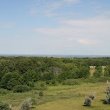
pj
Wednesday, July 11, 2007
Days 1 and 2 (July 10 and 11)
We made it to
We had dinner at the Mishawaka Brewing Company. There are loads of different restaurants in the area but we decided to try the local micro brew place. Of course, it had really good Irish fare. If you ever get there try the “Four Horsemen Irish Steak Pie”. It is to die for. And, of course, you must have the Stout with it. John had the Fish and Chips with an IPA, but he kept stealing bits of my dish.
We are now in
mm
Monday, July 9, 2007
Heading West
Well, we are about ready to hit the road tomorrow. I finally got John to lay out his cloths and to help me sort through all the things we think we'll need along the road. I hope there will be room for Sheila's stuff. We may have to strap her to the top of the car. Kidding!
As John has blogged, my quiet days alone are over. This should be interesting being with my husband 24/7 from now and until the end of our retirement. Other than a couple weeks for vacations in the last 38 years, we have never spent so much time together. A new adventure for us.
MM
As John has blogged, my quiet days alone are over. This should be interesting being with my husband 24/7 from now and until the end of our retirement. Other than a couple weeks for vacations in the last 38 years, we have never spent so much time together. A new adventure for us.
MM
Friday, July 6, 2007
Retired
OK, now I am officially retired. So far it doesn't feel any different, but I've only been retired for about 3 hours. Since we are so focused on planning for the trip, I haven't really thought much about the retirement aspect, but it did seem a little strange today when I was at work and realized it was my last day. It probably will not hit me until we return from the trip in August and I don't have to go back to work. Or maybe about two weeks into the trip when I realize I haven't gone to work for awhile.
We are really getting excited about the trip. We have been laying things out and making lists of what we will take. We went shopping today for the obligatory snacks to eat along the way -- mostly a variety of nuts and cereal and chocolate covered pretzels for Mary. Sheila sounds like she is ready to go also, and I think Rob and Angie are ready for us to leave them alone for awhile. Having house sitters is great. It really is nice to be able to go on a trip like this and not worry about the house. Except maybe for that party Rob has planned. 8^)
pj
Subscribe to:
Posts (Atom)